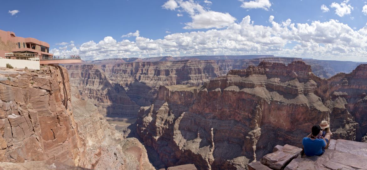
Which State Is the Grand Canyon In?
The entire Grand Canyon is located within the state of Arizona. The Grand Canyon is also close to the borders of Utah and Nevada and winds through some of the most extremely rugged and beautiful terrain in the entire nation.
Heading east to west, the Grand Canyon begins in the Northeast near the town of Page, AZ and continues westward for 277 miles. In fact, the Grand Canyon is so large (1,904 square miles in total), it occupies an area that is larger than the entire state of Rhode Island (1,212 square miles).

How Was the Grand Canyon Formed?
The canyon was created by the Colorado River and its many tributaries cutting into the Colorado Plateau as it uplifted, causing the Colorado River system to flow where it does today between sheer 4,000-foot walls of ancient rock. The canyon is so deep, it exposes rocks that date back the earliest parts of Earth's history, some as old as 1.8 billion years.
Today, the Grand Canyon is symbolically divided into several "rims", all of which are open for visitation and offer a variety of different sightseeing opportunities and activities.

Grand Canyon Rims
Grand Canyon South Rim
The North and South Rim combined comprise the official "Grand Canyon National Park". The National Park is so massive that if you want to drive from the North Rim to the South Rim, it is a 4.5-hour drive of 220 miles!
The South Rim is the most developed region of the park and offers plentiful shopping, dining options, hotels, museums, and historic buildings to explore. Here you'll find some of the most world-famous views of the Grand Canyon, and even opportunities to explore in a helicopter tour or across the canyon's edge in a Hummer ground excursion.
Grand Canyon North Rim
Conversely, the North Rim is a rugged and mostly untouched area, perfect for skilled hikers and campers. Because the North Rim is 1,000 feet higher in elevation than the South Rim and experiences heavy snowfall in winter, this area is completely closed to visitors from December to May. The only way to get from the North Rim to South Rim is a nearly five-hour drive or an arduous 24-mile hike along the Bright Angel Trail that takes you from the North Rim Village to the South Rim Village.
If you'd like to experience the North Rim but avoid those arduous travel options, you can see it from the sky on a North Rim helicopter tour departing from the South Rim!

Grand Canyon West Rim
The Grand Canyon West Rim, only 125 miles from Las Vegas, is the rugged, less-trafficked alternative to the Grand Canyon National Park. The West Rim is owned and operated by the Hualapai Indian Tribe and is not administered by the National Park Service. The West Rim is the home of breathtaking lookout points such as Eagle Point and Guano Point, the Grand Canyon Skywalk, and a Native American cultural center called Hualapai Point, which offers dining, authentic handmade crafts for sale, a shooting gallery, and a zipline.
Perhaps the most unique aspect about the West Rim is that it is the only area in the entire Grand Canyon where helicopters can land all the way on the very bottom. You can experience a West Rim helicopter tour that lands on the canyon floor from Las Vegas. If you're visiting the West Rim independently, you can also book a Grand Canyon helicopter tour that departs from the air terminal near the park entry.

Distance from Las Vegas to the Grand Canyon
The distance from Las Vegas, NV to the Grand Canyon depends on which part of the canyon you would like to visit.
Here are distances to each rim from Las Vegas:
How Long Does it Take to Get to the Grand Canyon from Las Vegas?
The distance from Las Vegas to the Grand Canyon depends entirely on which rim of the canyon you are wanting to reach.
- West Rim: Approximately 130 miles or two and a half hours driving
- South Rim: Approximately 280 miles or four and a half hours driving
- North Rim: Approximately 270 miles or four and a half hours driving
Instead of spending most of your trip to the Grand Canyon in the car, you can fly instead and cut your travel time in half! You reach the Grand Canyon West in a helicopter tour from Las Vegas in just a little over an hour! If you'd like to visit the Grand Canyon National Park, flights depart daily from the Boulder City air terminal near Las Vegas. You can fly to the South Rim in just 2 hours and 20 minutes. The aerial journeys to both destinations include bird's-eye views of Hoover Dam, Lake Mead, the Colorado River, and of course - the Grand Canyon.
How Far is the Grand Canyon from Phoenix?
- The distance from Phoenix to the Grand Canyon depends on which rim you are traveling to. The South Rim is the closest location to Phoenix, Arizona. The drive is approximately 224 miles and takes around three and a half hours.
- The Grand Canyon West Rim is approximately 260 miles and takes around four and a half hours to drive from Phoenix.
How Far is the Grand Canyon from Antelope Canyon?
Page, AZ, which is close to the Utah-Arizona border, is the closest large city to the Grand Canyon. It is also home to a number of magical Southwest destinations including Antelope Canyon, the most popular and photographed slot canyon in the American Southwest, the Colorado River's famous Horseshoe Bend, Lake Powell, America's second largest reservoir which is located in Glen Canyon National Recreation Area, Navajo Nation, Tower Butte, and much more.
You can easily incorporate an Antelope Canyon day tour from the Grand Canyon into your South Rim vacation plans with a short and scenic flight that includes a guided tour into Antelope Canyon and stop at Horseshoe Bend!